Due to changes to Googles terms and conditions for use of it's maps, we are transitioning The Active Transport Toolkit from Google Maps to Open Street Maps (https://www.openstreetmap.org). The open nature of Open Street Maps is a better fit for the us and will also help ensure that we can continue to provide the toolkit for free in the future. Please bare with us while we make these changes.
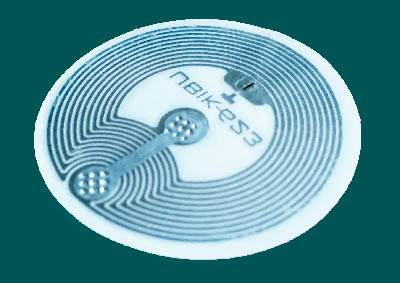
 Version 1.40.7 now supports NFC tags. The little tags can be bought for around $2-$3 (https://nicegear.co.nz/rfid/nfc-tag-universal-round-sticker/ for example). If you have a phone holder attached to your bike, an NFC sticker inside the holder can be used to start the ATT app automatically as soon as the phone is placed in the holder and paused when the phone is removed.
To use an NFC tag, all you need to do is create a 'Custom URI' record of 'att://activetransporttoolkit.com' using an NFC writer app ('NFC Tools' for example - https://play.google.com/store/apps/details?id=com.wakdev.wdnfc). Note that the record must be a custom URI and start with 'att://' and not 'http://'.
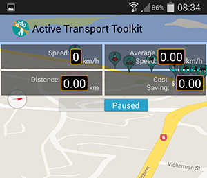
When in the 'pause' state, the GPS is turned off which is different to the 'sleep' state that occurs when a blackout area is entered. In the latter case, tracking resumes when the blackout area is exited as before unless is has become 'paused' while in the area. If the app is in a pause state, tracking will only resume either when an NFC tag is detected or when the pause switch is manually slid in to the tracking position.
 The latest version of the ATT fixes a few issues and also adds in a 'Pause' button. Just slide it across to temporarily stop tracking.
Note that the 'pause' button is only visible when tracking is turned on (to turn on tracking just check the 'Track My Route' option in the Tracker menu).
While paused the app will not use the GPS which will save power.
If tracking is on when the app is started and you're in a 'no track' area that you've created, once the app has a GPS position it will automatically change the pause button state to 'paused' and the app will go into 'sleep' mode. Once the 'no track' area is exited, tracking will resume and the pause button state will automatically change to 'tracking'.
Unlike in previous versions, if the app is closed while paused (either through the use of the pause button or because the device is in a 'no track' area), when the app is restarted tracking will be resumed.
If pause mode is enabled before entering a 'no track' area or before a GPS position has been attained from within a 'no track' area, tracking will not resume when the area is exited since GPS is turned off.
For help in creating 'no track' areas, see the Tracker Menu Documentation.
The on-line map has now been updated to include current marker positions so even if you're not running the app, you can still view any issues that have been reported.
A few recent markers have been left on the map so that you can see how it works - Just click on a marker to view the details.
Version 1.40.3 of the Active Transport Toolkit is now available to download from Google Play. If you have previously downloaded the app but were unable to register due to a password error please update to this latest version.
This version will work with Android 4.1 and above.
https://play.google.com/store/apps/details?id=com.lightlimited.bnb